CoordOS
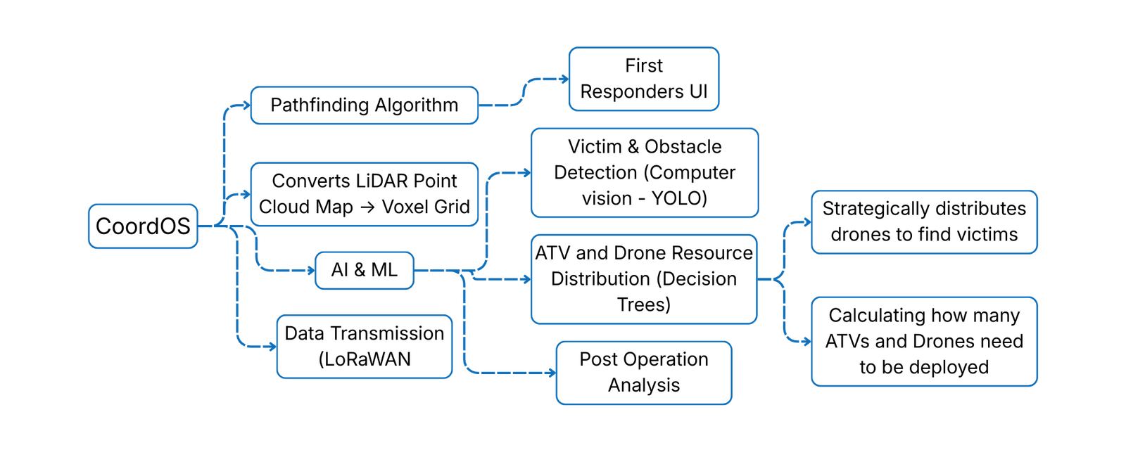
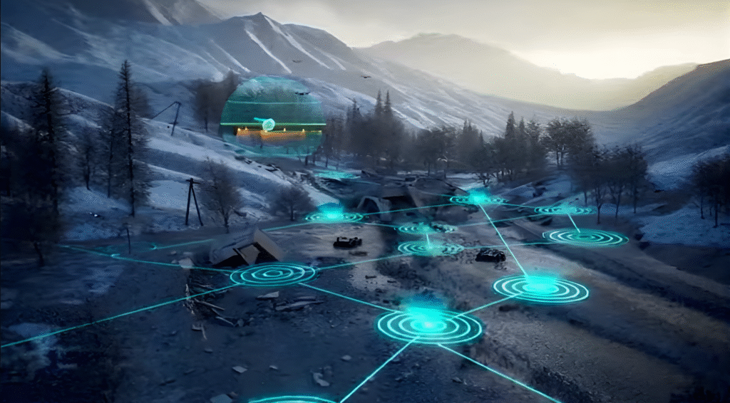
CoordOS is an innovative AIoT mesh network and processing server that underpins the entire CoordinAID ecosystem, with a core focus on intelligent CoordinAider ATV route generation to guide ground rescue assets. This state-of-the-art operating system enables seamless communication between the CoordiMate drone and the CoordinAider ATV, facilitating real-time data transmission and processing, and continuous optimization of ATV routes and changing disaster environments. Its intuitive interface and embedded machine learning models help first responders track mission parameters, prioritize victims, and coordinate rescue operations more efficiently.
LoRaWan
CoordOS utilizes LoRaWAN (Long Range Wide Area Network) technology, which provides reliable, low-power communication over considerable distances. This network ensures secure connectivity even in remote or challenging environments, supporting continuous data exchange that strengthens situational awareness for first responders.
Pathfinding Algorithm
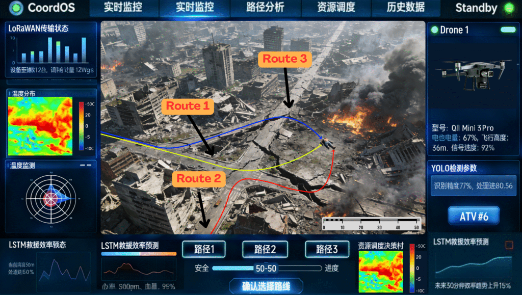
CoordOS uses CoordiMate’s LiDAR data to generate optimal routes for the ATV using the pathfinding algorithm. The algorithm is based on the A* algorithm framework.
The raw 3D point cloud data is converted into a 2D bird’s eye view format. This allows YOLO (computer vision) to identify potential obstacles. Then, the original 3D point cloud data is converted into a 3D voxel grid format. The pathfinding algorithm then analyzes the voxel grid data to find optimal routes using these 3 parameters whilst avoiding all detected obstacles.
- Efficiency (how fast can the ATV reach the victim)
- Safety (how safe is the route – are there obstacles, difficult terrain, etc.)
- Risk Weight (first responders can choose for the system to generate a safer / more efficient route)
Using the 3 criteria above, the algorithm will produce the 3 most optimal routes. First responders will then choose the final route amongst the 3, which will be the route that the ATV will follow to reach the victim.
AI & Machine Learning Integration
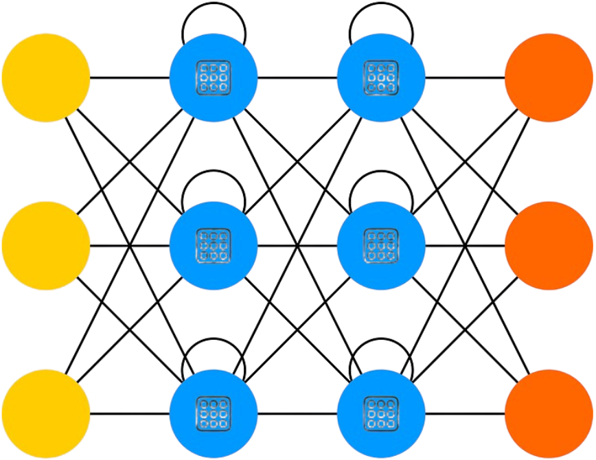
CoordOS doesn’t only act as a communication network hub or handles the pathfinding process, but is also responsible for acting as a processing server to deal with many high-end processing tasks.
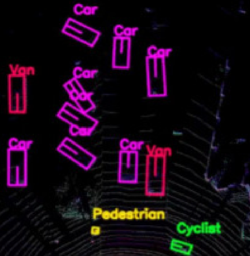
Computer Vision
Computer vision is used for victim identification, and also helps with the identification of obstacles and safety hazards in the rescue scene.
AI / ML Techniques: YOLO
Resource Distribution
Resource distribution of drones and ATVs are managed based on real-time situations, thus maximizing available resources.
AI /ML Techniques: Decision Trees
Post Operation Analysis
CoordOS analyses all rescue operations to identify areas of improvement in the future to elevate rescue efficiency.
AI / ML Techniques: Reinforcement Learning, LSTM
How it all works: